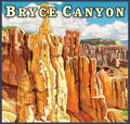
Hike Bryce Canyon With Frost River

After another trip out west to Utah where we visited some of the other national parks, we thought it would be fitting to talk about the parks that we spent time at. Come with us as we wander among the hoodoos for a taste of what this lesser traveled to park has to offer.
Celebrating the Centennial With A Little History
Bryce Canyon National Park is a breathtaking natural wonder that has captivated visitors for centuries. The park's history is deeply intertwined with the rich heritage of Native American tribes, including the Paiute, who lived in the region for thousands of years. Their presence is evident through various artifacts and petroglyphs found within the park. The area's first European explorers arrived in the late 18th century, with the famous Spanish explorer, Don Garcia Lopez de Cardenas, being credited as one of the earliest recorded visitors. However, it wasn't until the late 19th century that the region gained wider attention. In 1875, a group of Mormon settlers, led by Ebenezer Bryce, established homesteads in the area, and it was Bryce who lent his name to the canyon. Designated as a national monument in 1923 and later as a national park in 1928, Bryce Canyon's geological wonders and stunning hoodoo formations continue to draw millions of visitors annually, making it an iconic symbol of the American Southwest.


Bryce Canyon National Park's mesmerizing landscape results from millions of years of intricate geological processes. While canyon is in its name, Bryce Canyon is not actually a canyon, rather it is a collection of amphitheaters. Bryce Canyon is known for its remarkable collection of hoodoos—towering rock spires formed through the erosion of sedimentary rock layers. The forces of frost-wedging, rainwater erosion, and the continuous movement of water have shaped these stunning formations. The park's highest point is over 9,100 feet, while its lowest point is approximately 6,600 feet above sea level. The varied elevation levels offer diverse habitats that support a wide array of flora and fauna. The park's unique geology also contributes to its striking color palette, with hues ranging from vibrant reds and oranges to deep purples and earthy browns, creating a painterly display that transforms with the changing light throughout the day. Bryce Canyon National Park's unparalleled geography and geological wonders make it a must-visit destination for nature enthusiasts, photographers, and adventurers alike.

What To Do In Bryce Canyon
One of the main draws of Bryce Canyon are the unique landscapes and the hoodoos. Many of the hikes take you down from the rim into the amphitheaters where you can wander among the hoodoos. A very unique aspect of the park is that the entrance is on top of the plateau so when you enter it feels like a totally different place compared to what you see down below. There are hikes of varying difficulty and distance to meet the needs of anyone. From the Rim Trail to the Navajo Loop to the Fairyland Loop, all let you experience the park in different ways.
On top of many hikes, Bryce Canyon is also a phenomenal place to view the night sky as it has an apparent magnitude of 7.4 which means it's one of darkest places in the US (apparent magnitude is a measure of the brightness of a star or astronomical object as viewed from Earth and the lower the number, the brighter the object). Because of this Rangers host guided night hikes when there is a full moon as well as many different programs and event oriented around astronomy and the night sky.


A Few Reminders
Bring Water. Bryce Canyon sits at around 8000 feet above sea level so the elevation can have a big impact, especially when you are doing activities such as hiking.
Dress in layers, or at the very least pack layers. Since Bryce sits at a high elevation, the weather can fluctuate and it is typically much cooler than many of the other parks in Utah.
This one may seem quite obvious but Stay On Marked Trails. The ecosystems in the park can be quite fragile and humans can do quite a bit of damage without realizing it!
Want a way to track the parks you have been to and learn about them and others? Look no further than our National Park Maps! Check out the second quadrant and pair it with the first to have the west half of the US complete.
Get Outfitted
Devil's Kettle Daypack
Perfect size for a day hike without getting to bulky and offering the maximum amount of attachment points for versatile carrying options.
Lookout Daggett Pack
If you are looking to hike in style, look no further than the Lookout Daggett, with a host of features and pockets and leather detailing, you are sure to stand out on the trail.
High Falls Short-Day Pack
A purpose built daypack, large enough for the essentials but slim enough that you almost won't notice it's there. With a few exterior attachment points, a small zip pocket and an interior sleeve that fits a water bladder, you'll be able to fit all you need for any day excursion.
Frost River’s National Park Guide
Need a bit of inspiration in planning your next trip? Look no further than our National Park Guide Quadrant One and Two. Each map covers a different region of the U.S. and provides quick fun facts about each of the parks it covers. Quadrant One details the Pacific Northwest to the Midwest, and Quadrant Two explores the Southwest Region.


